
Erica asked me to do Riddian next, but I had to veto that — we don’t see the province of Riddian until Book 3, whereas we start Book 1 in the city-states of Illane. And I actually have a map with them on it!
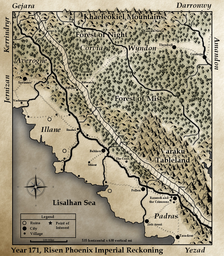 The three main city-states of Illane are, north to south: Savinnor (or the Cornerstone), Bahlaer, and Fellen. Somewhat south of Fellen is the Illane/Padras border at the Padrastan city of Kanrodi. To the east is the Rift, with Varaku along its southern stretch; to the west is the Lisalhan Sea, where the old empire of Lisalhan sank more than a millennium ago and took much of the intermediary land with it.
Most of Illane is arid, due to the hot wind that blows up from the Desert of Aervach most of the year. Temperatures stay high and rain is infrequent. At about the Ilnaher mark (the small dot above Bahlaer), the climate becomes more temperate, and the land changes from flat to hilly, but a dry heat persists even to Savinnor for much of the year.
Starting from the south — and where Cob’s story begins: the Illane/Padras border.
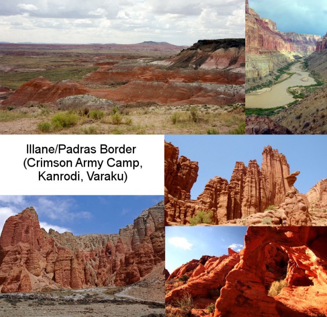
No good pictures to replicate the Rift at the moment, so you’ll have to imagine a huge cliff rising a few thousand feet above/behind the red rocks shown here. The Losgannon River is shallow, slow and murky in this area — except during the few weeks of torrential rain that come in winter.
Next to the north is Fellen, discussed but as yet unseen in the story:
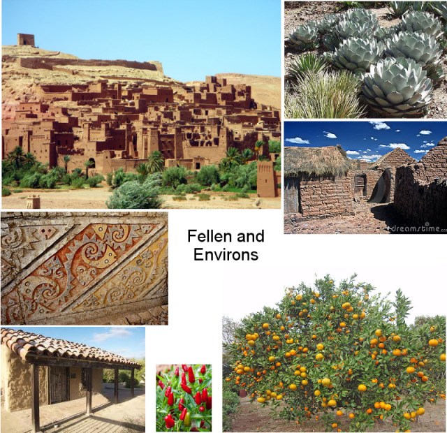
A badlands city, dependant on irrigation and dryland agriculture as well as trade with the upriver and downriver cities. The blockade that the Crimson Army has placed against Kanrodi has deeply impacted Fellen — but even more so the riots that went on during the Crimson’s occupation of the city. Composite here needs a bit more work, but that can wait.
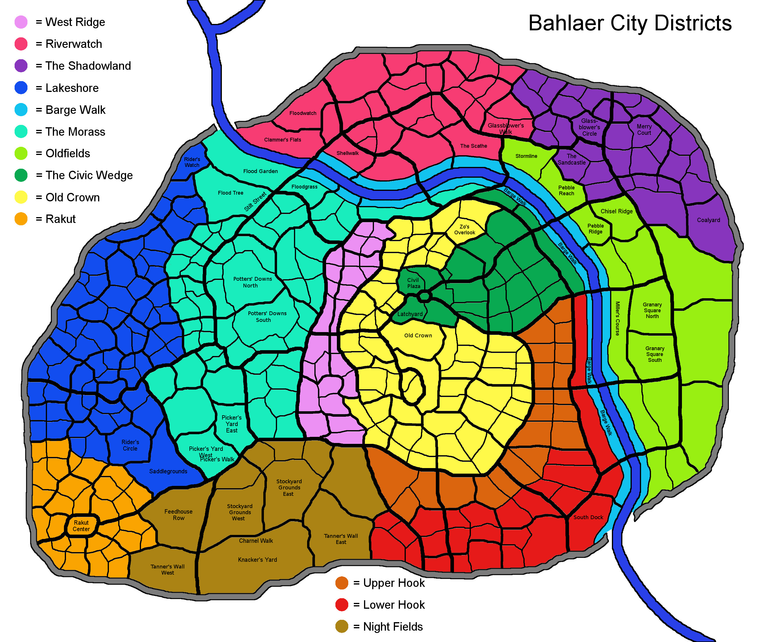
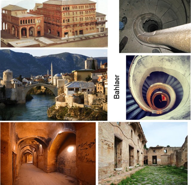
Next, and most important, is Bahlaer.
I haven’t made much recent progress on the city map, so here’s the one I had from before:
 Starting with the area between Bahlaer and Fellen — which includes Ammala Cray’s homestead — this is a rough view of the environment:
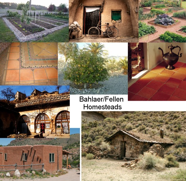
Ignore the bicycle. Some ranching (goat, cattle, horse, in order of prevalence), some farming (irrigated or arid), with the farming increasing in proportion the further toward Bahlaer you go. Between Ammala’s area and Bahlaer itself, grain- and vegetable-farming becomes the main occupation of the rural populace.
Bahlaer is more solidly built and more prosperous than Fellen. It stands on the bones of older cities and has been reinforced from below, with the Losgannon River flowing narrow and fast through a man-made course:
It also likes its colors:

As do the people:

Some of the Illanic attire holds true throughout the city-states, though in Fellen there tends to be more white, with broader hats and influences from Padras and further south (to be examined later). To the north, in Savinnor, there are influences from Jernizan, Averogne and Gejara — utilitarian, muted and block-print bright respectively.
Speaking of Savinnor, it sits on the oft-contested border between Illane and Jernizan, with Averogne to the north and a productive trade-route coming down from Gejara and Kerrindryr to meet the Imperial road at Savinnor’s center. Much of Savinnor’s great wall is built of stone from the Low Country Kerrindryr quarries; having been broken down several times by invading armies, the wall is constantly being rebuilt, with the citizens sometimes cannibalizing its stone for their own constructions.
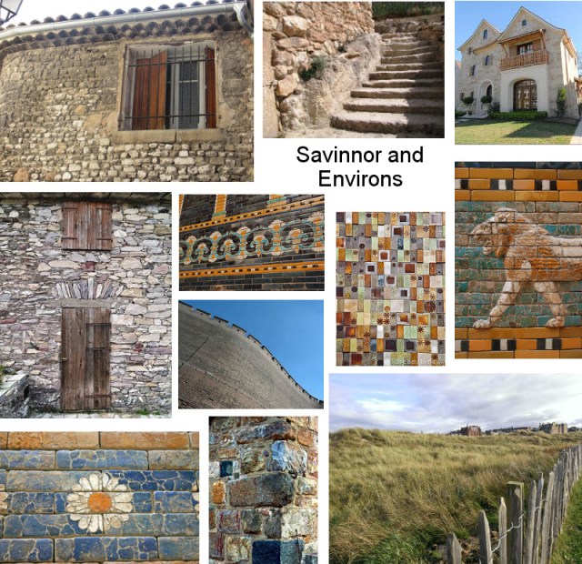
Around Savinnor and reaching east to the Rift Climb and the town of Riftward, the land becomes hilly and covered in orchard, vineyard and terraced fields. The Rift Climb area receives a reasonable amount of rain and the Losgannon River is broadest here, making it the most productive terrain in Illane.
Lastly, I leave you with my artist friend’s rendition of Ammala Cray, based on an appearance I generated from the character-creator in the game Aion (very useful, btw):
 And there you have it….for now.


So… I get the hot desert wind, but Illane is right next to the ocean, so how can it be arid? Especially since the Rift would block any clouds blowing inland.
Proximity to water does not itself cause a wet climate. The coasts of Africa’s desert, most of the Middle East, parts of the American Southwest and the Atacama Desert in South America are all directly adjacent to water. In this case, the dry wind from the Desert of Aervach is channeled up along the Rift, generally forcing any other weather systems away from Illane until winter when the cold wind through the Pinch comes down. Moist air can flow from the sea toward the Rift but it is generally cooler than the Aervach wind, so does not rise, therefore does not condense to rain until it has gone further north and the Aervach wind has petered out a bit. Bahlaer is really the turning point where the Aervach wind drops in temperature enough for a reasonable climate.
But weather isn’t the only factor in desertification; groundwater and soil composition also matter. The Illanic area used to have abundant groundwater — before the Sealing. When the Sealing happened, Lisalhan broke off from the continent, leaving huge sea-cliffs at Illane’s western border — cliffs riddled with caves that used to hold its underground streams and reservoirs. All of that water poured into the sea, and surface water has continued to drain down through those opened channels ever since. Desertification set in badly, causing the old biome to die and the topsoil to be swept away by rain and wind. Illane currently has hard-baked dirt as topsoil, which can’t absorb much water, causing great amounts of runoff and flooding during the rainy times — without being able to refill any of those deep reservoirs, only seasonal lakes. If not for the Losgannon River, much of the southern part would be uninhabitable.
So…yeah. 😀